Conservation
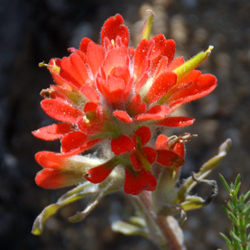
Indian Paintbrush
Castilleja affinis
One of the unique characteristics of the South Coast Chapter area is its geological and biological links to the Channel Islands. Indeed, some of the rare plants of the Palos Verdes Peninsula only occur in one other spot – – the Channel Islands.
Although much of the area encompassed by our chapter boundaries has been urbanized, our area also includes the only remaining segment of coastal sage scrub between the Santa Monica Mountains and Orange County. The protection and preservation of native habitat has been a primary focus of our chapter over the years.
Local Conservancies
Catalina Island Conservancy
Channel Islands National Park
Los Cerritos Wetlands Land Trust
Palos Verdes Peninsula Land Conservancy
Acquisition of Upper Filiorum Property
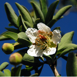
California rockflower, Catalina crossosoma
Crossosoma californica
On December 7, 2009, the South Coast Chapter Board of Directors voted to contribute $10,500 from the operating account towards the acquisition of Upper Filiorum, the last remaining available open space to complete the Palos Verdes Nature Preserve.
The purchase price for the 190-acre property was $6.5 million. The California Coastal Conservancy provided $5.5 million, and the City of Rancho Palos Verdes provided $600,000. The balance of $400,000 was raised by the community, and the acquisition occurred on December 30, 2009.
Acquiring the land allows the Three Sisters, Portuguese Bend, and the Forrestal reserves to be linked, forming a contiguous 950-acre corridor for wildlife habitat.
For more information:
Daily Breeze article of January 3, 2010 – Need Link
Palos Verdes Nature Preserve
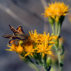
Dune Buckwheat (hosting male El Segundo Blue)
Eriogonum parvifolium
The South Coast Chapter provided extensive input regarding the Natural Communities Conservation Plan (NCCP) that was created by the City of Rancho Palos Verdes and approved on August 31, 2004. The final plan provided for preservation of almost all of the remaining open space in the City, although significant acreage was still subject to development, depending on the willingness of sellers and the availability of public funds for land acquisition.
In order to help the City implement the NCCP, the California Coastal Conservancy authorized a grant of up to $5.5 million on September 25, 2008 to purchase the 190-acre Upper Filiorum property.
The source of funds for the $5.5 million grant was an appropriation to the Conservancy from Proposition 84, the Coastal Protection Bond Act of 2006. Consistent with the purposes specified in the Act, the acquisition of the Upper Filiorum property would protect natural habitat values of coastal lands on the Palos Verdes Peninsula, as well as promote access to and enjoyment of coastal resources of the state.
As indicated above, the Upper Filiorum property was acquired on December 30, 2009.
Effective 2012, the City established a 24/7 hotline for reporting misuse of the Preserve and for accessing Preserve information. A hotline operator will record information and forward to the Mountain Recreation and Conservation Authority (MCRA) Rangers or other appropriate agencies, such as the Lomita Sheriff’s Department, California Department of Fish and Game, Palos Verdes Peninsula Land Conservancy or City Staff.
MRCA Rangers patrol the City’s 1,450-acre Preserve an average of 45 hours per week to both educate the public on Preserve use and enforce City Ordinances. Below are concerns that are addressed by the Ranger Hotline:
- Dogs off-leash
- Dogs/horses/animals on beach
- Hikers/cyclists/equestrians off trails
- Misuse of trails (i.e., bicycles or horses on pedestrian-only trails)
- Reckless use of Preserve trails
- Motorized vehicles
- Removal/destruction of flora/fauna
- Removal or destruction/modification to Preserve signage
- Illegal dumping
- Littering
Please call the Hotline at 310-491-5775 to report misuse of the Preserve.
For more information about the Palos Verdes Nature Preserve, please see the following City of Rancho Palos Verdes web page:
Palos Verdes Nature Preserve
Machado Lake Ecosystem Rehabilitation Project
Sawtooth Goldenbush
Hazardia squarosa var. obtusa
On November 2, 2004, the voters of Los Angeles overwhelmingly passed Proposition O, a $500 million bond issue for open space improvement projects.
Out of the $500 million authorized, a total of $117 million has been committed to Machado Lake and the Wilmington Drain, which form an interconnected open space in and around the 241-acre Ken Malloy Harbor Regional Park near Wilmington and Harbor City.
Among other project components is habitat improvement, including removal of non-native invasive plants, and planting of appropriate native riparian species.
The South Coast Chapter provided input during the eight public meetings from September 2008 to July 2009, and at a scoping session for the Environmental Impact Report on September 17, 2009.
The Draft Environmental Impact Report was released in March 2010, a related public meeting occurred on April 27 and the comment period ended May 3, 2010.
Project staff conducted a community workshop on August 17, 2010 to provide a general update and receive additional comments from the public. The Final EIR was certified on September 28, 2010.
Project staff conducted an additional community workshop on September 14, 2011 to provide a summary of project refinements and receive additional comments from the public. The rehabilitation project commenced in Spring 2014 and is on schedule to be completed in Spring 2017.
Phase 1 of the project was completed in Spring 2015. The Wilmington Drain, a 27-acre section at the north end of the project (between Lomita Boulevard and PCH) was dedicated as the “Harbor City Greenway” and opened to the public on June 20, 2015.
For more information, please see the following:
Proposition O Background – Need Link
Environmental Reports
Progress reports, pictures and video – updated April 2015
Marine Life Protection Act Initiative
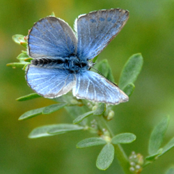
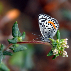
Deerweed (hosting male Palos Verdes Blue)
Lotus scoparius
The MLPA directed the state to reevaluate and redesign California’s system of marine protected areas (MPAs) for more effective protection of the state’s marine life and habitats.
The MLPA also required that the best readily available science be used in the redesign process, as well as the advice and assistance of scientists, resource managers, experts, stakeholders and members of the public.
California used a regional approach to redesigning MPAs along its 1,100 mile coastline, and divided the state into five study regions. The planning process for the South Coast Region (Point Conception to the Mexican border) commenced during the summer of 2008.
In a letter dated October 15, 2009, the South Coast Chapter recommended the highest level of protection for the Palos Verdes Peninsula. After studying the three competing proposals, we strongly favored Proposal 3, which would create by far the most protection for shoreline habitats such as beaches, rocky shores, and surf grass beds.
Palos Verdes is one of the few places within the South Coast Region where one can find a huge diversity of habitats, including the rocky intertidal, sandy and gravel beaches, surf grass beds, kelp forest, underwater pinnacles, and submarine canyon walls. It also harbors marine mammal haul outs, and critical bird and marine mammal foraging areas.
Following public meetings in December 2009, California Fish & Game Commission staff initiated development of the appropriate CEQA and regulatory documents. A Draft Environmental Impact Report was released on August 18, 2010 and a Final EIR was released on December 7, 2010 (see link below to download).
After receiving additional public testimony, the Commission adopted the proposed MPA regulations on December 15, 2010.
It is gratifying that the regulations actually protect more habitat than what was contemplated under Proposal 3. The Point Vicente SMCA (State Marine Conservation Area) provides a “Very High” level of protection for 3.69 miles of shoreline, and the Abalone Cove SMCA provides a “High” level of protection for 1.23 miles of shoreline. The SMCA designations also protect almost 20 square miles of submerged habitat off these Palos Verdes shorelines.
The South Coast Chapter thanks members of the local community who wrote letters and testified at the public hearings in support of these historic protections!
As of January 1, 2012, the Point Vicente and Abalone Cove SMCAs are in effect. Confidential tips regarding poaching or polluting within the SMCAs can be called in to (888) DFG-CALTIP.
For more information, please see the following California Department of Fish & Game data sources:
California Marine Protected Areas
MPA Planning Process Historical Information
Map of South Coast Marine Protected Areas – October 31, 2011
Final Environmental Impact Report – December 7, 2010